Naturpark Pfyn-Finges
Cable-Car Gampel - Jeizinen
Travel time: 8.5 minutes
In Gampel the connections to the bus line Leuk-Turtmann - Gampel/Steg - Visp (timetable field 12.491) are granted during the given operating hours.
Funicular
Travel time: 8.5 minutes
In Gampel the connections to the bus line Leuk-Turtmann - Gampel/Steg - Visp (timetable field 12.491) are granted during the given operating hours.
Extra trips for schools and groups are available on request and by arrangement. For the cable car and the bus you can use the following phone number: +41(0)27 932 15 50
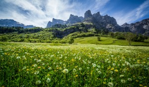
Torrent in summer - beautiful mountain scenery to enjoy, but also to perform various activities.
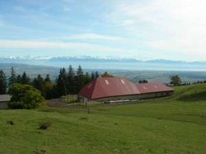
The winter sports area Torrent above Leukerbad and ALbinen offers something for everyone
Leichte Rundwanderung im Val Schons. Von der Burgruine Cagliatscha über die sanierte Maillart-Brücke zur Sixtina der Alpen - die Wanderung führt von einer Sehenswürdigkeit zur anderen und gibt Einblicke in die Kultur des Val Schons.
This stage of the trail offers an array of pre-alpine landscapes through the Petit Mont and Gros Mont valleys. The final ascent takes you through the Vallon des Morteys. The arrival point, the Les Marindes refuge is the ideal spot to observe wildlife
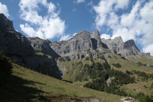
This all-mountain tour in the heart of Leukerbad's rocky arena will make mountain bikers' hearts beat faster: breathtaking scenery, magical views and trail action.
Our Champlönch children’s trail offers a completely new experience.
Leukerbad - Birchen - Bodmen - Inden - Rumeling - Tschingern - Albinen - Dorben - Leukerbad
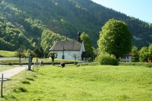
5 Villages, 8 chapels, a trail for body, mind and soul
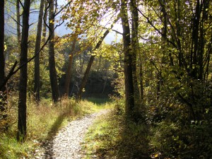
The charcoal makers of Romoos are the last to practice the ancient craft of charcoal burning in Switzerland. The thematic path explains this skill in more detail. The trail leads across mountain ridges and through wild canyons and is a good represent...
This stage of the trail takes in the scenic Breccaschlund (Brecca gorge), home to an incredible variety of wild flora and fauna and offering magnificent views of the surrounding landscapes, some of which appear in the Federal Inventory of Landscapes
The trail connects the two villages Charmey and Crésuz. It gives the walker a wonderful panorama view of the Jaunbach valley and the valley of Javroz.
Ce sentier proposé par le Parc Gruyère Pays-d’Enhaut et les communes de Châtel-sur-Montsalvens, Crésuz, Val-de-Charmey et Jaun met en valeur le patrimoine bâti et les traditions vivantes de la vallée.
Use our new smartphone app to explore the Heritage of the Park.
Between nature, culture and heritage
Two sides, two languages
Die leidenschaftliche Alpkäserin Esther Gfeller hat einen beliebten Wanderweg zu einem informativen Themenweg mit 16 Infotafeln über das Älplerleben aufgewertet.
This excursion from the summit of the Chasseral to Chaumont is made for those who prefer the descent to the ascent. You will be taken gently down and up from the mountain peeled by the biting winter to the dense forests of the hillsides.
Gehen Sie durch die wilde «Combe Biosse» im Val de Ruz, unterhalb des Chasseralgrats, um zum Gipfel zu gelangen. Der Abstieg erfolgt durch die Wälder und Weiden des Chasserals.
A must among the walking routes ...
This ideal family walk leads from Chasseral over the Chasseral ridge with a gentle slope down to Les Prés-d'Orvin: panoramic view, pastured woodlands, alpine mountain flora ...
From Château-d'Oex, one proceeds along the railway track and the stream, over meadows and pastures, until the village of Les Moulins is reached, where BIO Gruyère cheese is produced.
This stage of the trail runs along the foot of the Gummfluh and its imposing rocky slopes, through La Pierreuse nature reserve and into the L’Etivaz valley. The trail offers panoramic views that stretch from the Pays-d’Enhaut and the Vaud Alps.
Luftige Kreten, tiefe Schluchten - Rundwanderung von Mümliswil auf das Chellenchöpfli. Eine traumhafte Aussicht belohnt Sie auf dem Gipfel.
Die Wanderung ist Teil der Wander Challenge "26 Summits" von Blick.
This hike takes you through lovely meadows and forests up to the Jura’s Dôle Mountain and over to La Givrine.At the summit with a 360° panorama, you will have a breathtaking view of Lake Geneva, Mont Blanc in France and the Jura crest and plateau.
Le chemin des fontaines a été créé en 2003 par la ville de Lausanne à l'occasion des journées mondiales de la forêt et de l'eau. Source: Randoresto.ch
Le chemin des fontaines a été créé en 2003 par la ville de Lausanne à l'occasion des journées mondiales de la forêt et de l'eau.
Le chemin des fontaines a été créé en 2003 par la ville de Lausanne à l'occasion des journées mondiales de la forêt et de l'eau. Il nous permet de découvrir la forêt et les sources des bois du Jorat.Source: RandoResto.ch
Sept itinéraires écotouristiques de randonnée, qui emmènent à la découverte du patrimoine culturel et naturel du Val-de-Ruz. Des panneaux didactiques renseignent les voyageurs.
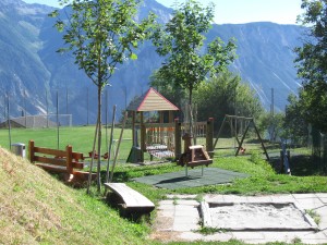
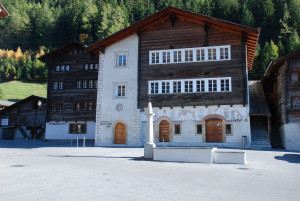
Children's playground Albinen
Cycle through endless vineyards, past breathtaking viewpoints, through lush pastures and rustling woodlands. Be enchanted by the charm of the wine-growing villages and treat yourself to a good drop of Blauburgunder!
Eine abwechslungsreiche Tour durch die Romooser Napflandschaft.
The five kilometre "Chriesiwäg" (cherry trail) goes through the beautiful landscape of the Frick valley and provides interesting information about cherry-growing.
A lovely circle hike leading from the lakeside village of Le Pont to the summit of the mountain Dent de Vaulion and return to Le Pont via Pétra Félix.
All along this loop, you’ll be tempted to stop in each village where you’ll find savoury regional products. Groceries, butcher shops, cheese shops, and charming inns all offer culinary delights to whet your appetite !
This wonderful circular hike lasts about 4:30 and leads to the alpine pastures around Leukerbad. The paths are well developed so that the hike is suitable for a wide public.
Marshy sites and authentic villages.
A legacy of the last ice ages.
Entdecken Sie die Naturlandschaft im Gebiet der Sèche de Gimel bevor Sie vom Gebirgspass Col du Marchairuz aus Ihren Abstieg nach Le Brassus fortsetzen. Entdecken Sie unterwegs die Wytweiden, und Trockensteinmauern der Grande Rolat und der Meylande.
Ausgehend vom Gebirgspass Col du Marchairuz folgt die Route entlang des Jura-Höhenwegs bis zum Crêt de la Neuve, von wo aus man eine wunderschöne Aussicht auf den Genfersee geniessen kann. Der Weg verläuft dann oberhalb Arzier nach Saint-Cergue.
Ab dem Gebirgspass Col du Marchairuz führt der Weg am Pré de Rolle vorbei, bevor er in den Wald hineinführt. Nicht zu verpassen ist der Rocher l’Eau pendante mit seiner nie versiegenden Quelle auf dem Weg nach Saint-George.
Diese Wanderung führt von den Jurahöhen bergab bis zu den Weinbergen des Genfersees, vom Gebirgspass Col du Marchairuz über die charmanten Dörfer Bière und Saint-Livres bis nach Aubonne.
Ein schöner Abstieg vom Gebirgspass Col du Mollendruz bis zum Lac de Joux. Der Weg führt durch Wälder und Wytweiden über den kleinen Ort Pétra Félix, bevor es zu Le Pont und seinem malerischen Hafen geht.
Diese schöne Wanderung führt über die kleine Beiz «Buvette de Châtel» bis zum wunderschönen Aussichtspunkt Croix de Châtel. Der Abstieg verläuft durch den Wald bis zum charmanten Dorf Montricher.
Vom Gebirgspass Col du Mollendruz aus führt die Route über die typischen Wytweiden des Jurabogens bis zum Kluniazenserstädtchen Romainmôtier.
The trials leads to Châtel-sur-Montsalvens in a superb course that is listed in the inventory of historical traffic routes in Switzerland. Afterwards the trail descends to the Broc chocolate factory and to Gruyère.
From the middle of the village the trail descends to the Lac de Montsalvens, then along the lake to the dam of Châtel-sur-Montsalvens - the first arch dam in Europe. The trail then leads to the little town of Gruyère.
High biodiversity and a Mediterranean ambiance
Distance 11 km
Time required 3 h
Altitude difference: Ascent 180 m
Altitude difference: Descent 260 m
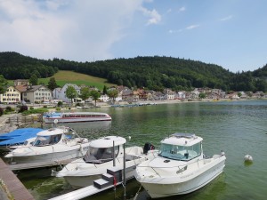
First class boats sailing for you on an enchanted river: The Doubs.
Die Cufercalhütte SAC ist ein guter Ort, um sich nach fast 1000 Höhenmeter Beinarbeit zu erholen. Hier könnte man gut auch eine Nacht bleiben - die flowige Abfahrt über die Moor- und Weidelandschaft ist am nächsten Tag mindestens so schön...
Already the ancient Romans were familiar with the healing powers of water and wine. The old Roman road connects the bathing experience with wine tasting.
The starting point for this cultural trail is the village square in Ernen. The hiking trail begins at Michligschrota via Mosshubel to Mühlebach. From there it leads up the steep village street to the chapel. The panoramic trail back to Ernen begins a