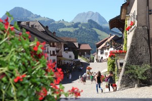
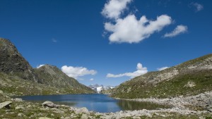
Navigating the Swiss Parks Website
Map

Hikes

In the Swiss parks
Show filter

All Parks

All offers

The offer is suitable for

Accessibility

Routes: Time required

Routes: requirements

472 offers
Jurapark Aargau

Frick Valley high-level trail

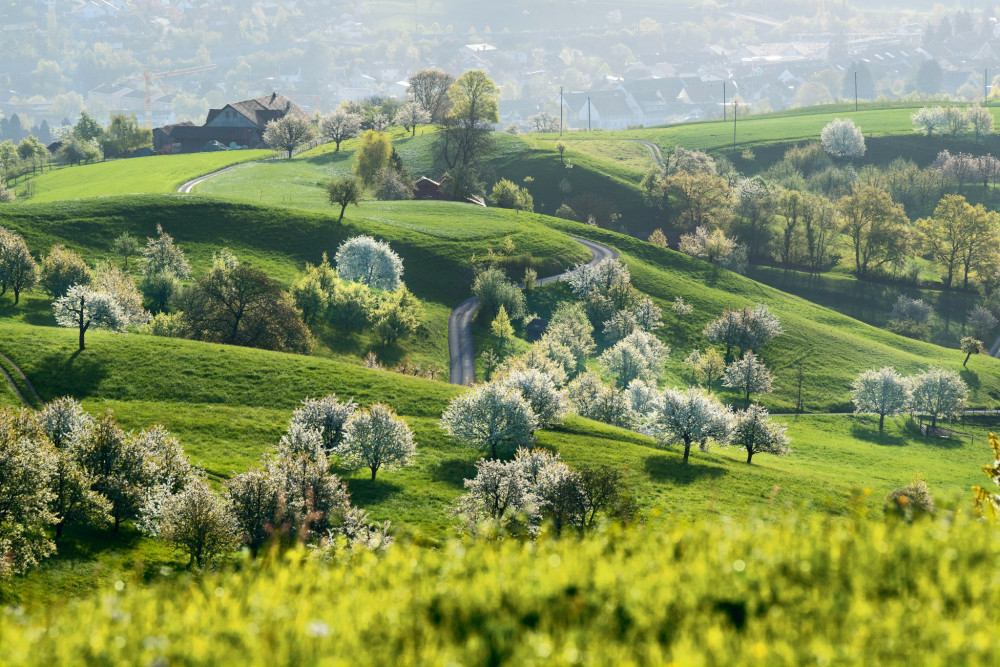
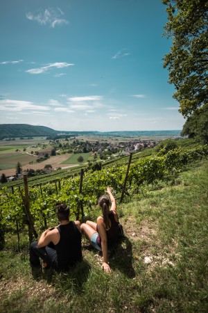
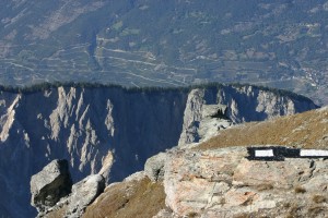
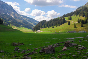
The Frick Valley high-level trail stretches over 60 kilometres from the beautiful old town of Rheinfelden over the table Jura plateau and the wild Tiersteinberg past viewpoints and pine forests full of orchids until it reaches Mettauertal.
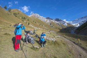
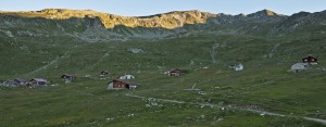
Hiking trail
Time required: 16 hours 24 minutesLength: 59.19km
Jurapark Aargau

Fricktaler Höhenweg (1): Rheinfelden - Zeiningen

Aus der geschichtsreichen Zähringerstadt Rheinfelden durch grüne Wälder hoch zum Sonnenbergturm – wer gerne genussvoll wandert, ist auf dem Fricktaler Höhenweg genau richtig.


Hiking trail
Time required: 3 hoursLength: 9.99km
Jurapark Aargau

Fricktaler Höhenweg (2): Zeiningen - Wegenstetten

Zweite Etappe des Fricktaler Höhenwegs von Zeiningen nach Wegenstetten


Hiking trail
Time required: 3 hours 30 minutesLength: 9.69km
Jurapark Aargau

Fricktaler Höhenweg (3): Wegenstetten - Frick

Der Fricktaler Höhenweg - 60 gut ausgeschilderte Wanderkilometer die in jeder Jahreszeit verzaubern!

Hiking trail
Time required: 3 hours 10 minutesLength: 11.50km
Jurapark Aargau

Fricktaler Höhenweg (4): Frick - Sennhütten

Unterwegs von Frick nach Sennhütten führt der Weg durch Gehölz, durch kühle Wälder und vorbei an historischen Grenzsteinen.


Hiking trail
Time required: 4 hours 15 minutesLength: 14.25km
Jurapark Aargau

Fricktaler Höhenweg (5): Sennhütten - Mettau

Der Fricktaler Höhenweg - 60 gut ausgeschilderte Wanderkilometer die in jeder Jahreszeit verzaubern!


Hiking trail
Time required: 4 hours 30 minutesLength: 16.46km
Parc naturel régional Jura vaudois

From one pass to the other !

Discover the Parc Jura vaudois by using the Postbus and link the two passes Marchairuz and Mollendruz by foot.

Hiking trail
Time required: 4 - 6hLength: 16.00km
Naturpark Beverin

Fünf Bergseen in zwei Tagen

Diese Wanderung führt Sie zur Alp Curtginatsch, der höchstgelegenen Kuhalp des Kantons, zu den Bergseen Lai Grand und Lai Pintg und weiter zur Cufercalhütte SAC. Am zweiten Tag folgt der Abstieg vorbei an drei idyllischen Bergseen.

Hiking trail
Time required: 9 hours 30 minutesLength: 24.50km
UNESCO Biosphäre Entlebuch  

Fürstein - a walk between Waldemme and Lake Sarnen

This mountain walk on the Fürstein leads through the wonderful scenery of the UNESCO Biosphere Entlebuch and Obwalden.

Hiking trail
Time required: 3 hours 40 minutesLength: 9.34km
Regionaler Naturpark Schaffhausen

Gälenfritz - 1. Etappe

The route offers you a diverse trail with culinary, cultural, scenic and recreational highlights. Visit the Klettgau member municipalities of the Schaffhausen Regional Nature Park

Hiking trail
Time required: 2 hoursLength: 6.70km
Regionaler Naturpark Schaffhausen

Gälenfritz - 2. Etappe

The route offers you a diverse trail with culinary, cultural, scenic and recreational highlights. Visit the Klettgau member municipalities of the Schaffhausen Regional Nature Park

Hiking trail
Time required: 4 hours 30 minutesLength: 19.60km
Naturpark Gantrisch

Gantrisch Panoramatrail (SchweizMobil 379)

Der Gantrisch-Panoramaweg bietet wunderschöne Aussichten auf die Voralpen und die Jurakette. Die Höhenwanderung verläuft auf gut ausgebauten und signalisierten Wanderwegen. Ein Highlight ist dabei der Gäggersteg!


Hiking trail
Time required: 6 hours 55 minutesLength: 21.10km
Parc naturel régional Gruyère Pays-d'Enhaut

Gastlosen Tour

Vertical north faces and sculpted south-facing slopes

Hiking trail
Time required: 4 hoursLength: 10.90km
UNESCO Biosphäre Entlebuch  

Gastronomic circular hike in Sörenberg

Open

A trail through moorlands of national importance takes in delicious examples of regional cuisine in three different restaurants.

Hiking trail
Time required: 2 hours 30 minutesLength: 8.80km
Schweizerischer Nationalpark

Geführte Exkursion Cluozza – Murtersattel

Diese etwas anspruchsvollere Exkursion führt nach Ihrer Übernachtung in der Cluozza-Hütte über den Murtersattel zum Ofenpass. Sie verspricht Saurierspuren, Tierbeobachtungen, artenreiche Alpenflora und eine beeindruckende Aussicht.

Hiking trail
Time required: 7 hoursLength: 7.50km
Naturpark Pfyn-Finges

Gemmi - Daubenhorn

Enjoy the unforgettable view on this hike to the summit of the Daubenhorn.

Hiking trail
Time required: 2 - 4hLength: 5.16km
UNESCO Biosphäre Entlebuch  

Gfellen-Schimbrig round walk

Enjoy an ever-changing walk around the Schimbrig. Your reward for tackling the steep climb, which demands surefootedness and concentration, are amazing views from the summit of the Entlebuch mountains, the Pilatus with Lake Lucerne, and the Bernese A...

Hiking trail
Time required: 5 hours 20 minutesLength: 14.42km
Naturpark Gantrisch

Gipfelwanderung Gantrisch, 2176 m.ü.M

Der Gantrisch ist nicht nur auf Bildern wunderschön anzuschauen, sondern auch die Wanderung bietet einiges – herrliche Aussichten, abwechslungsreiche Landschaften und anspruchsvolle Passagen.


Hiking trail
Time required: 3 hours 30 minutesLength: 9.14km
Naturpark Gantrisch

Gipfelwanderung Kaiseregg, 2185 m.ü.M

Hoch hinaus mit schönem Blick auf den Schwarzsee, die Jurahöhen sowie zum Breccaschlund. Die Gifpelwanderung auf die Kaiseregg bietet viel Aussicht. Ob mit Fahrt mit der Bergbahn oder direkt vom Schwarzsee aus - die Tour kann nach Bedarf angepasst...

Hiking trail
Time required: 4 hours 20 minutesLength: 11.74km
Naturpark Gantrisch

Gipfelwanderung Ochsen, 2188 m.ü.M

Die Wanderung auf den höchsten Berg des Naturpark Gantrisch bietet wunderschöne Aussichten vom Mittelland, bis ins Oberland und in die Freiburger Alpen.


Hiking trail
Time required: 3 hours 25 minutesLength: 7.93km
UNESCO Biosphäre Entlebuch  

Glaubenbielen - Sattelpass - Seewen - Stäldili - Flühli

Die Wanderung vom Glaubenbielen-Pass nach Flühli führt Sie durch fantastische Moorlandschaften und vorbei am kleinen Bergsee «Sewenseeli».


Hiking trail
Time required: 6 hours 10 minutesLength: 20.15km
UNESCO Biosphäre Entlebuch  

Glaubenbielen - Sörenberg

Longish walk  in demanding mountain and moorland terrain featuring a wealth of views.

Hiking trail
Time required: 3 hours 35 minutesLength: 9.78km
Naturpark Pfyn-Finges

Grand Canyon? Illgraben!

Alps, flowers, mountain lakes and a unique view into the Valais Grand Canyon

Hiking trail
Time required: > 6hLength: 17.00km
Parc naturel régional Gruyère Pays-d'Enhaut

Grand Tour des Vanils

The Grand Tour des Vanils is divided into 11 stages around the Park. The tour can be done in its entirety, in stages or by combining them over several days.

Hiking trail
Time required: 70 hoursLength: 158.00km
Parc naturel régional Gruyère Pays-d'Enhaut

Grandvillard - Lessoc

The trail leads out of Grandvillard , then over the stream of Les Marais to below the waterfall and to the grotto, which is a place of Gruyère pilgrimage . In the village centre there is a well with its imposing cupola.

Theme trailHiking trailOther routes
Time required: 1 hour 15 minutesLength: 4.20km
Naturpark Pfyn-Finges

Green Lizard Trail

Superb stroll through the vineyards with a view of the forest of Pfyn/Finges nature reserve
Distance 2 km
Time required 0 h 45
Altitude difference: Ascent 50 m
Altitude difference: Descent 50 m

Theme trailHiking trail
Time required: 45 minutesLength: 2.00km
Landschaftspark Binntal

Grengiols – Bister cultural trail (circular route)

Open

Short hike starting in the picturesque village of Grengiols to the small, beautiful village of Bister and back again.

Hiking trail
Time required: 2 hoursLength: 6.20km
Landschaftspark Binntal

Grengiols – Firsitten – Grengiols

Open

An interesting circular trail that leads you past a number of cultural highlights. The hike takes about 4-5 hours. The route can also start with the Tulip Ring.

Hiking trail
Time required: 4 hours 20 minutesLength: 10.42km
Landschaftspark Binntal

Grengiols – Zenhäusern – Bister – Grengiols

Open

A varied circular walk that takes you past a traditional irrigation channel (Suone) to Zenhäusern, Binnelti, Bister, and back to Grengiols. The hike lasts about 3 hours.

Hiking trail
Time required: 3 hoursLength: 9.00km
Parc régional Chasseral

Grenzsteinweg

Betrachten Sie alte Grenzsteine, welche vor 1950 gesetzt wurden und die Grenze der früheren Gemeinden Tramelan-Dessus und Tramelan-Dessous markierten.

Theme trailHiking trail
Time required: 2 - 4hLength: 5.30km
Naturpark Diemtigtal

Grimmialp pushchair circuit

The easy circular walk is ideal for a Sunday stroll with your family. The play posts on the Grimmimutz adventure trail are especially exciting for the little hikers.

Hiking trail
Time required: 1 hour 45 minutesLength: 5.46km
Naturpark Diemtigtal

Grimmimutz adventure trail

A circular trail with several stations where you can play and have fun has been created based on the children’s story about the adventures of the Waldmandli Grimmimutz (a mythical forest dweller called Grimmimutz) and the evil Pepper Witch written...

Hiking trail
Time required: 1 hour 30 minutesLength: 4.14km
Parc naturel régional Gruyère Pays-d'Enhaut

Gros Mont - Abländschen

Open

From one side of the Gastlosen to the other, via the Col du Loup

Hiking trail
Time required: 4 hours 20 minutesLength: 10.70km
Parc naturel régional Gruyère Pays-d'Enhaut

Gros Mont - Mittelberg

Open

Via Col du Loup and Grubenberghütte

Hiking trail
Time required: 4 hours 20 minutesLength: 10.80km
Parc naturel régional Gruyère Pays-d'Enhaut

Gros Mont – Château-d’Œx

Open

From Gros Mont to Pays-d'Enhaut

Hiking trail
Time required: 5 hours 20 minutesLength: 16.60km
Naturpark Pfyn-Finges

Grossi Wasserleitu

Diversity of nature on a picturesque trail along the rippling water course. Walk along the Suone Neuf (Bisse Neuf) and the Grossi Wasserleitu from Varen (Varen irrigation channel). Both irrigation channels take their water directly from the Raspille

Hiking trail
Time required: 2 - 4hLength: 12.00km
Naturpark Pfyn-Finges

Gruben – Höhenpfad – Oberems

The narrow trail leads through beautiful and wild alpine landscapes across all types of terrain and numerous streams, and past idyllically situated alpine huts.

Hiking trail
Time required: 4 - 6hLength: 13.00km
Parc naturel régional Gruyère Pays-d'Enhaut

Gruyères - Estavannens

The trail leads from the little town of Gruyère past the Maison du Gruyère and then further in the direction of the Saane valley. Then it ascends again between forest and meadows to the village of Estavannens.

Theme trailHiking trailOther routes
Time required: 1 hour 45 minutesLength: 6.30km
Parc naturel régional Gruyère Pays-d'Enhaut

Gruyères – Neirivue

The trail leads from the little town of Gruyère past the Maison du Gruyère and then further in the direction of the Saane valley. Then it ascends again over meadows to the village of Neirivue.

Theme trailHiking trailOther routes
Time required: 3 hoursLength: 10.00km
Schweizerischer Nationalpark

Guided walk Macun

The excursion begins at the alp Zeznina climbs up to Macun and back. Particularities: Macun lakes (23 lakes), crystalline soil flora, pygmy buttercup (only occurrence in Switzerland), rock glacier.

Hiking trail
Time required: 8 hoursLength: 16.00km
Schweizerischer Nationalpark

Guided walk Margunet

The walk leads us through an interesting section of the Pass dal Fuorn forests and the wonderfully varied flora of the Park’s alpine meadows. The nature trail provides detailed information along the way, in 5 languages.

Hiking trail
Time required: 3 hoursLength: 7.00km
Schweizerischer Nationalpark

Guided walk Val Trupchun

Particularities: mixed alpine forests with good opportunities for observing animals, in particular red deer, ibex and marmots; varied vegetation. Mainly on the level, this walk is suitable even in bad weather.

Hiking trail
Time required: 7 hoursLength: 14.00km
Naturpark Gantrisch

Gürbe-Wildwasserweg (SchweizMobil 382)

Die Wanderung führt auf  dem abenteuerlichen Weg im wilden Gürbegraben bis nach Wattenwil. Unterwegs gibt es über hundert Sperren aus Holz und Beton, welche die Kraft des Wildbachs Gürbe bremsen.


Hiking trail
Time required: 3 hours 10 minutesLength: 10.82km
Naturpark Gantrisch

Gürbetaler Höhenweg (SwitzerlandMobility 380)

This day hike leads along the eastern flank of the Längenberg on natural paths with gentle ups and downs to the Gürbebadi in Mühlethurnen. Picnic areas, barbecue sites and benches as well as several farm shops are recommended for a break.


Hiking trail
Time required: 5 hours 30 minutesLength: 18.22km
Wildnispark Zürich Sihlwald

Hausen am Albis – Oberrieden

Diese spannende Wanderung mit vielen Höhenmetern führt einmal quer durch den Naturwald Sihlwald und endet am erfrischenden Zürichsee.

Hiking trail
Time required: 2 hoursLength: 10.00km
Wildnispark Zürich Sihlwald

Hausen–Sihlwald–Horgen

This hike leads through the wilderness park of Zurich Sihlwald, the largest natural beech mixed woodland in the central part of Switzerland.

Hiking trail
Time required: 3 hours 30 minutesLength: 11.40km
Naturpark Beverin

Heinzenberg Ridge Hike

Obertschappina - Glaspass - Glasergrat - Lüsch - Bischolpass - Tguma - Präzer Höhi - Präzer Alp - Prau da l'Alp - Saloms - Pranzolas - Prau Sdunon - Präz
Wunderful view over Safiental on the left side and Domleschg on the right side.

Hiking trail
Time required: 6 hours 30 minutesLength: 18.00km
Jurapark Aargau

Hike "Linn Lime Tree"

After climbing Linnerberg with its magnificient view of the Alps, the hike “Linner Linde” takes you over Buechmatt to the Schenkenberg Ruins, the biggest ruin of Aargau. A way along the vineyards leads you to the wine-growing village of Thalheim.

Hiking trail
Time required: 2 hours 36 minutesLength: 9.24km
Naturpark Pfyn-Finges

Hike 4 Alps

Jeizinen - Unneri Meiggu - Oberi Meiggu - Heruhubel - Feselalpe - Jeizinen

Hiking trail
Time required: 4 - 6hLength: 14.00km
Naturpark Diemtigtal

Hike Anger (Zwischenflüh)-Turne-Diemtigen

You start at the Anger cattle showground and climb almost 1000 metres in altitude on this day. The climb to the Turne is definitely worth it, because the panoramic view is unique.

Hiking trail
Time required: 5 hours 35 minutesLength: 15.20km