Parc naturel régional Gruyère Pays-d'Enhaut
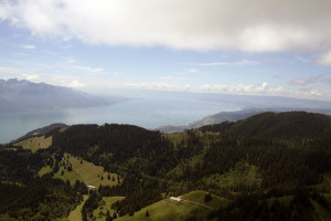
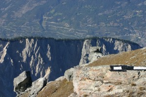
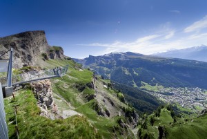
Rochers-de-Naye – Rossinière
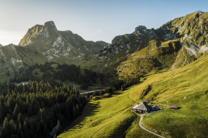
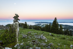
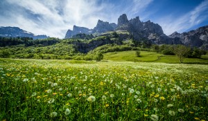
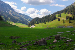
Hongrin valley: a land of cheese and water
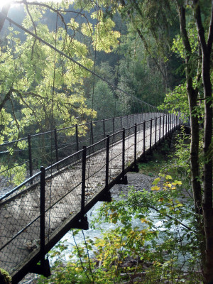
Hiking trail
Time required: 6 hours 30 minutesLength: 18.70km
Hongrin valley: a land of cheese and water
A legacy of the last ice ages.
Marshy sites and authentic villages.
From the Grand Chalet to the alluvial zone of the Sarine.
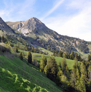
La Pierreuse, green pastures, and limestone slopes
Two passes, two worlds
From the Allières relay station to the Montbovon crossroads
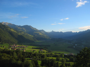
A journey through a peaceful valley
Between two teeth and three valley
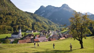
Between Gruyères and Intyamon
Between nature, culture and heritage
Two sides, two languages
A gentle stroll through the Javro valley
Vertical north faces and sculpted south-facing slopes
From tranquil mountain pastures to tumultuous waterfalls.
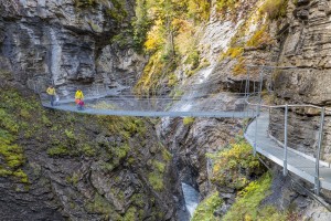
The Chauderon gorges are closed until further notice.
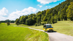
Three Parks Tour, six stages, Zweisimmen-Gruyères
This route leads from Schaffhausen up to the Jura heights. From there you follow a circular path into the Eschheimtal valley. The path is, sometimes wooded, sometimes lined by meadows and fields.
Jeweils am Sonntag mit toller Aussicht vom Brunnersberg zum Passwang wandern und dabei immer wieder an Bergrestaurants vorbeikommen - das ist die NaturparkBus Beizen-Tour.
This hike impresses with its scenic diversity. Along the way, numerous viewpoints offer beautiful views of the Rhine, which meanders gently through the valley.
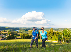
Via Le Gruyère AOP
Walks through the park - between villages and valleys on a tour of discovery to the pearls of its historical heir, on the trail of cheese. The new app, the cheese trails, is your companion!
A relatively gentle but continuous uphill hike from Les Prés-d'Orvin to the summit of the Chasseral following the ridge and through typical forests and wooded pastures. Panoramic views, alpine flora and the Chasseral antenna are on the menu.
This excursion from the summit of the Chasseral to Chaumont is made for those who prefer the descent to the ascent. You will be taken gently down and up from the mountain peeled by the biting winter to the dense forests of the hillsides.
Walks through the park - between villages and valleys on a tour of discovery to the pearls of its historical heir, on the trail of cheese. The new app, the cheese trails, is your companion!
AUFGRUND UNWETTER IST DIE WALLFAHRTSKAPELLE ST.ANTONIUS IM HORNGRABEN VON EINER EINZIGEN GERÖLLHALDE UMGEBEN UND NICHT BEGEHBAR.
.
Spektakuläre Rundwanderung von Matzendorf auf das Rüttelhorn. Eine traumhafte Aussicht belohnt Sie auf dem Gipfel.
Superb stroll through the vineyards with a view of the forest of Pfyn/Finges nature reserve
Distance 2 km
Time required 0 h 45
Altitude difference: Ascent 50 m
Altitude difference: Descent 50 m
Gemmi Pass - Lämmerenboden: a pasture landscape of national importance
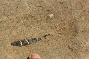
The panorama trail for Fossil connoisseurs - the origin of thermal water
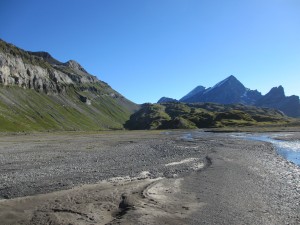
Alps, flowers, mountain lakes and a unique view into the Valais Grand Canyon
The Turtmann Valley: wild and romantic a testament to its glacier
Catch Ibex and Chamois on their evening walks.
Cultural village of Albinen - Fire area and WSL research - Brentjong field flora
Eine kurzweillige Rundwanderung in Hellikon mit spannenden Informationen rund um Bäume.
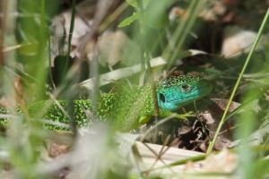
Bird life in the region of Leuk: Leukerfeld, High Bridge, Brentjong
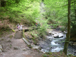
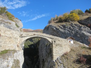
Dramatic and poetic through the Dala Gorge, source of many springs
Distance 3.5 km
Time required 1 h 30
Height difference ascent 180 m
Height difference descent 180 m
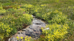
Diversity of nature on a picturesque trail along the rippling water course. Walk along the Suone Neuf (Bisse Neuf) and the Grossi Wasserleitu from Varen (Varen irrigation channel). Both irrigation channels take their water directly from the Raspille
Hamlet of Colombire (Montana) - Tsittoret irrigation channel - Valley of Tièche - Colombire
Ecological Museum Colombire - Tsittoret irrigation channel (Suone) - Waterfalls
High biodiversity and a Mediterranean ambiance
Distance 11 km
Time required 3 h
Altitude difference: Ascent 180 m
Altitude difference: Descent 260 m
Leukerbad - Birchen - Bodmen - Inden - Rumeling - Tschingern - Albinen - Dorben - Leukerbad
5 Villages, 8 chapels, a trail for body, mind and soul
Already the ancient Romans were familiar with the healing powers of water and wine. The old Roman road connects the bathing experience with wine tasting.
Discover unspoilt centuries-old village centres on the sunny mountain:
Leukerbad - Albinen - Sämsu - Brentschen - Engersch - Jeizinen
Distance 17 km
Time required 5 h 15
Altitude difference: Ascent 760 m
Altitude difference: Descent 630 m
Leuk-Leukerbad
Distance 10km
Duration 4h
Altitude diff. Ascent 950m
Altitude diff. Descent 200m
Leukerbad-GemmiPass
Distance 5km
Duration 2h30
Altitude diff. Ascent 950m
Gemmi Pass-Kandersteg:
Distance 15km
Duration 4h
Altitude diff.
The highlights of the Binner Alpe in one day: alpine pastures, the lonely and mineral-rich valley of the Turbewasser, the high moor on the Blatt and the idyllically situated Halsesee.
From Gros Mont to Charmey, via La Monse
From the Gros Mont to the Intyamon
From Gros Mont to Pays-d'Enhaut
From one side of the Gastlosen to the other, via the Col du Loup
Via Col du Loup and Grubenberghütte
Die sehr lange Tageswanderung führt Sie über Hagleren (Naturschutzgebiet), den höchsten Aussichtspunkt, über Pfade in wilder und urtümlicher Landschaft.
Geniessen Sie die herrliche Aussicht auf der Haglere aufs Dorf Sörenberg und die umliegenden Berge.