Navigating the Swiss Parks Website
Map

Hikes

In the Swiss parks
Show filter

All Parks

All offers

The offer is suitable for

Accessibility

Routes: Time required

Routes: requirements

494 offers
Naturpark Gantrisch

ViaJacobi Etappe 30 (SchweizMobil 4)

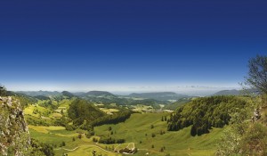
Mit der Hauptstadt im Rücken, führt der Weg durch Wälder und Dörfer, immer mit dem Blick auf die Markanten Berner Dreigestirne Eiger, Mönch und Jungfrau.
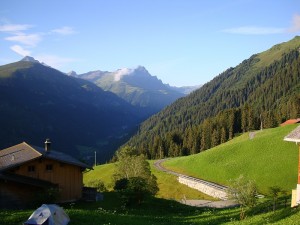
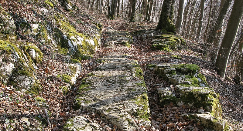
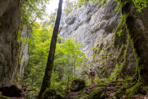

Hiking trail
Time required: 6 hours 20 minutesLength: 21.92km
Naturpark Gantrisch

Vreneli-Wäg Guggisberg

Der Rundweg folgt der Geschichte von Vreneli und Hans-Joggeli. Er bietet herausragende Ausblicke, eine schöne Wegführung, verschiedene Rastplätze und Erlebnisstationen für Klein und Gross.


Hiking trail
Time required: 2 hours 30 minutesLength: 5.35km
Jurapark Aargau

Waldlehrpfad Heuberg

Rundroute im Laufenburger Wald mit Informationen zu Nadelbäumen, Laubbäumen und Sträuchern. 


Theme trailHiking trail
Time required: 39 minutesLength: 2.35km
Naturpark Pfyn-Finges

Walk Albinen-Leukerbad

Over the Torrent alp towards Folljeret and Leukerbad through alpine meadows and peaceful woods.

Hiking trail
Time required: 4 - 6hLength: 9.50km
Naturpark Pfyn-Finges

Walk Erschmatt - Leuk

From Erschmatt follow the hiking trail in the direction of Leuk and soon arrive at the High Bridge. Then plunge into the fire-red magnificence of the smoke bushes. After go along the bank of the river to Leuk railway station.

Hiking trail
Time required: 2 - 4hLength: 8.20km
Naturpark Pfyn-Finges

Walk Leuk - Agarn

This walk starts at the satellite ground station, goes over traditionally cultivated fields in Brentjong to the rocky steppes. Having arrived in the Rhone valley, we recommend walking through Leukerfeld, which is outstanding for bird-watching.

Hiking trail
Time required: 4 - 6hLength: 11.00km
Naturpark Pfyn-Finges

Walk Leukerbad - Jeizinen

Walking over hill and alp.
The walk passes 6 different alps. The fantastic view of the Valais mountain world, marmots and bearded vultures are among the points of interest on this walk.

Hiking trail
Time required: 4 - 6hLength: 17.00km
Naturpark Pfyn-Finges

Walk Leukerbad - Salgesch

Walk on historical trails
Leukerbad – Varen ladders – Salgesch
From Leukerbad the cultural trail towards Salgesch goes through agricultural regions, sections of woodland and past rock faces.

Hiking trail
Time required: 4 - 6hLength: 13.00km
Naturpark Pfyn-Finges

Walk Miège - Leuk

From Sierre railway station we drive with the bus to Miège church, where the walk starts. We cross the terraced vineyards in the golden autumnal light and follow the signposted wine trail to Leuk.

Hiking trail
Time required: 2 - 4hLength: 10.80km
Naturpark Pfyn-Finges

Walk Sierre - Salgesch

Discover wine and water between Sierre and Salgesch. The walk goes from Sierre past the Gironde Lake and along the wild Rhone to Salgesch. A wine-tasting stop at one of the wine partner companies is well worthwhile.

Hiking trail
Time required: < 2hLength: 5.00km
Naturpark Beverin

Walk to the lake of Libi

From Mathon over flower meadows to Libi mountain lake. This beautiful lake in the mountain landscape with its barbecue area is the ideal spot for a break. Go down the alpine road to the village of Lohn, where the Echo Forest entices you to visit.

Hiking trail
Time required: 4 hoursLength: 8.00km
Naturpark Pfyn-Finges

Walking through Pfyn forest

An exciting walk across the forest of Pfyn/Finges nature reserve. Discover the points of interest in the nature reserve.

Hiking trail
Time required: 4 hoursLength: 14.00km
Naturpark Pfyn-Finges

Walking-tour Illgraben - Bhutan bridge

Length 7 km
Hiking time 2 h 00
Height difference up 250 m
Height difference down 250 m

Hiking trail
Time required: 2 hoursLength: 7.00km
Naturpark Pfyn-Finges

Walking-Tour: Fascinating Forest Fire Area

Cultural village of Albinen - Fire area and WSL research - Brentjong field flora

Hiking trail
Time required: 2 hoursLength: 8.00km
Naturpark Beverin

Walser trail Safiental (3 days)

The Safien Walser Trail runs in 3 stages from the Rhine Gorge to the back of the Safien valley. The main direction leads from north to south, into the valley.

Hiking trail
Time required: 13 hours 30 minutesLength: 34.00km
Naturpark Beverin

Walser trail Safiental Stage 1

From Versam you will climb steadily upwards past the Brüner Alp and up to the Tenner Chrüz. The view towards Ringelspitz and Tschingelhörner becomes more and more impressive. From the Tenner Chrüz you look into Safiental. Now it’s downhill to Tenna.

Hiking trail
Time required: 5 hoursLength: 16.50km
Naturpark Beverin

Walser trail Safiental Stage 2

The 2nd Stage of the Safiental Walser trail takes you from Tenna to the valley floor via the Egschisee and then along the Rabiusa. You walk through enchanting riverside forests with diverse vegetation until you reach Safien Platz.

Hiking trail
Time required: 4 hoursLength: 10.40km
Naturpark Beverin

Walser Trail Safiental Stage 3

The Safien Walser Trail runs in 3 stages from the Rhine Gorge to the back of the Safien valley. The main direction leads from north to south, into the valley.

Hiking trail
Time required: 4 hoursLength: 11.10km
Naturpark Beverin

Walserweg Graubünden Etappe 3

Von Vals über den Tomülpass führt diese Route durch alpine abwechslungsreiche Landschaft ins Safiental. Weite Strecken dieser Etappe sind historische Polenwege.

Hiking trail
Time required: 5 hours 30 minutesLength: 13.10km
Naturpark Beverin

Walserweg Graubünden Etappe 5

Diese Wanderung führt Sie entlang der ehemals wichtigsten Verbindung aus und ins Safiental. Steil hinauf auf den Glaspass und danach sanft hinunter nach Thusis.

Hiking trail
Time required: 5 hours 20 minutesLength: 17.00km
Naturpark Beverin

Walserweg Graubünden Etappe 7

Ein Transitweg führte einst vom Albulatal über Samest ins romanische Schams. Wir folgen seinen Spuren und geniessen die Sicht hinüber zum Schamserberg überragt vom Piz Beverin.

Hiking trail
Time required: 4 hoursLength: 15.00km
Naturpark Beverin

Walserweg Graubünden Etappe 8

Vorbei am grünen Andeer Granit, durch die Roflaschlucht und hinein ins vom Bergbau geprägte Val Ferrera.

Hiking trail
Time required: 4 hours 45 minutesLength: 14.00km
UNESCO Biosphäre Entlebuch  

Wanderplausch und Biergenuss in Marbach

Offen

Eine Tour mit tollen Aussichten und gemütlicher Wanderung ganz für Bier-Liebhaber.


Hiking trail
Time required: 2 hoursLength: 7.94km
Jurapark Aargau

Wanderquiz Saalhöhe

Mit einer Fotokarte ausgerüstet geht es auf die spannende Rätsel-Wanderung. Spielerisch wird die Jurapark-Landschaft auf der Saalhöhe erkundet.


Theme trailHiking trail
Time required: 1 hour 40 minutes
Jurapark Aargau

Wanderung auf dem Römerweg

Wanderung auf dem alten Römerweg vom Bözberg nach Effingen. 

Hiking trail
Time required: 1 hour 25 minutesLength: 5.44km
Naturpark Gantrisch

Wanderung Vrenelidorf Guggisberg - Rüschegg

Eine Wanderung mit wunderschöner Aussicht auf die Hügellandschaft des Naturpark Gantrisch: Vom Guggershorn in die Schlucht des Gambach


Hiking trail
Time required: 3 hours 25 minutesLength: 10.22km
UNESCO Biosphäre Entlebuch  

Wanderweg Escholzmatt-Wiggen-Marbach

Der kinderwagentaugliche Wanderweg Escholzmatt-Wiggen-Marbach ist mit gemütlichen und abwechslungsreichen Verweilzonen ausgestattet.

Hiking trail
Time required: 2 hours 30 minutesLength: 9.60km
Landschaftspark Binntal

Wasen – Hockmatta – Blatt – Schärtbrigga – Steinmatten

Closed

Short hike from Wasen down to the beautiful Hockmatta and on to the picturesque Steinmatten.

Hiking trail
Time required: 1 hour 45 minutesLength: 4.60km
Naturpark Thal

Wasserfallen-Kamm Route

From the Wasserfallen top station you walk to the fantastic viewpoint of Vogelbergfluh and descend to the former comb-making village of Mümliswil. Regional gourmet treats await you in the mountain restaurant and in Mümliswil.

Hiking trail
Time required: 2 hours 30 minutesLength: 7.00km
Parc Ela

Wasserweg ansaina

Auf 12 Kilometern entlang der Albula, des Landwassers und des Schaftobelbachs wandern Sie auf dem Wasserweg ansaina. Es sind Orte zum Verweilen, zum Beobachten und zum Staunen. Der Wasserweg beginnt beim Bad Alvaneu.

Theme trailHiking trail
Time required: 2 hours 30 minutesLength: 12.00km
Regionaler Naturpark Schaffhausen

Waterway Neunkirch

Open

The water trail takes you from the historic town centre to revitalised streams
revitalised streams, inviting fountains and reservoirs. Along the way
ten informative boards await you along the way.

Theme trailHiking trail
Time required: 1 hour 45 minutesLength: 6.80km
UNESCO Biosphäre Entlebuch  

Wiggen - Wachthubel - Marbach

Auf dieser Wanderung haben Sie wunderbare Aussichten auf das Dorf Marbach sowie die sagenumworbene Schrattenfluh.


Hiking trail
Time required: 4 hours 30 minutesLength: 12.35km
UNESCO Biosphäre Entlebuch  

Wiggen – Marbach

Offen

Die leichte Wanderung immer der Sonne entgegen!

Hiking trail
Time required: 1 hour 35 minutesLength: 6.05km
Naturpark Pfyn-Finges

Wildlife Watching

Catch Ibex and Chamois on their evening walks.

Hiking trail
Time required: 2 - 4hLength: 7.00km
Regionaler Naturpark Schaffhausen

Wine Trail Beringen-Löhningen

On the Wine Trail, you'll learn many exciting and interesting things about winemaking and related topics.

Theme trailHiking trail
Time required: 1 hour 30 minutesLength: 3.00km
Regionaler Naturpark Schaffhausen

Wine trail Trasadingen

Open

Since 2001 Trasadingen - as the first community in the canton - has had a wine nature trail.

Theme trailHiking trail
Time required: 40 minutesLength: 2.67km
UNESCO Biosphäre Entlebuch  

Wissemme-Weg von Escholzmatt nach Schüpfheim

Gemütliche Familienwanderung auf dem idyllischen Wanderweg entlang der Wissemme.


Hiking trail
Time required: 2 hours 26 minutesLength: 9.12km
Jurapark Aargau

Wölflinswil Perimuk trail

Perimuk 's friend the Toad lives in Wölflinswil and he has thought up a puzzle for Perimuk and you. Solve the animal puzzle on the way and work out the code with the numbers of the solution - then you can open the safe at the end of the trail.

Theme trailHiking trail
Time required: 1 hour 58 minutesLength: 7.14km
Naturpark Thal

Wolfsschlucht-Weg

This tour reveals the different aspects of the Thal Nature Park. From Welschenrohr, the route leads to the beautiful and wildly romantic Wolf Gorge, through which you ascend to continue hiking in the lofty heights of the second Jura chain.

Hiking trail
Time required: 4 hours 45 minutesLength: 13.00km
Landschaftspark Binntal

Ze Binne - Breithorn - Heiligkreuz - Ze Binne

Open

The hike starts in the hamlet of Ze Binne and ascends from the reservoir up to Saflischmatta, where it's worth taking a break by the charming chapel.

Hiking trail
Time required: 7 hours 45 minutesLength: 20.00km
Landschaftspark Binntal

Ze Binne – Wilere – Schmidigehischere

Open

Follow the marked hiking trail "Wilere" in the direction of the church. Once you arrive there, follow the hiking trail in the direction of "ze Binne".

Hiking trail
Time required: 25 minutesLength: 1.00km
Jurapark Aargau

Zwei Dörfer-Rundweg

Auf dem familienfreundlichen Zwei Dörfer-Rundweg zeigen sich Wölflinswil und Oberhof von ihrer besten Seite.


Theme trailHiking trail
Time required: 2 hours 30 minutesLength: 8.08km
Landschaftspark Binntal

Z’Brigg – Niederernen (circular route)

Open

The Z'Brigg group of buildings takes its name from the river crossing. The once important settlement on the Rottenbrücke is now reduced to a few buildings.

Hiking trail
Time required: 50 minutesLength: 2.50km
Naturpark Pfyn-Finges

«Devil's Fingers»

The panorama trail for Fossil connoisseurs - the origin of thermal water

Hiking trail
Time required: 2 - 4hLength: 8.50km