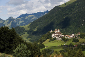
Notre-Dame-des-Marches
This chapel is the most important sanctuary dedicated to the Virgin Mary in the canton of Fribourg.
All season
Parc naturel régional Gruyère Pays-d'Enhaut - The trials leads to Châtel-sur-Montsalvens in a superb course that is listed in the inventory of historical traffic routes in Switzerland. Afterwards the trail descends to the Broc chocolate factory and to Gruyère.
This chapel is the most important sanctuary dedicated to the Virgin Mary in the canton of Fribourg.
This dam, located along the Jogne river, is responsible for Montsalvens lake. Built between 1918 and 1921 by engineer Heinrich Eduard Gruner, it was the first arch dam in Europe with both horizontal et vertical curves. 52m high and 110m long, its con...

The history of the town of Gruyères is intimately tied to that of the family of counts of the same name. Mentioned for the first time in the 12th century, they distinguish themselves by their title (very few held this title amongst the counts of Sav...

This community is located on the slopes above Montslavens Lake, with an unobstructed view from its some 910 meters elevation. In the 17th century the village was completely destroyed by a fire. In 1667, the vicarage was the only building that escape...
To optimise your experience on our website we use cookies. Privacy policy aI agree
