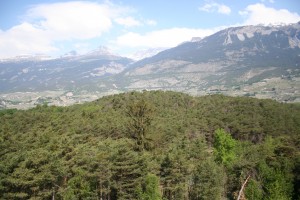
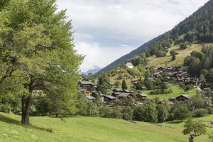
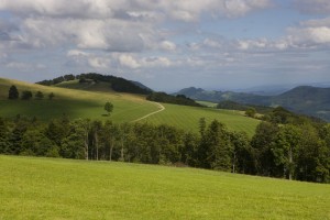
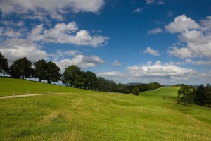
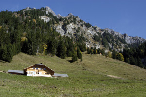
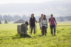
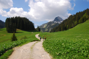
Hike Meienberg-Anger (Zwischenflüh)
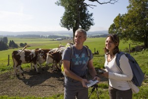
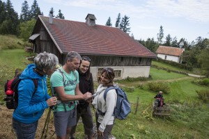
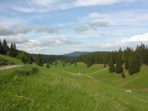
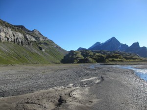
Hike from the Simmental into the Diemtigtal, from Alp Meienberg to Anger (Zwischenflüh). A culinary hike into the heart of the Diemtigtal Nature Park.
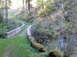
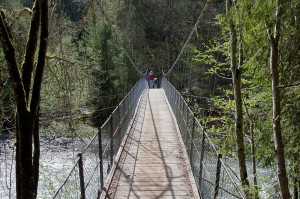
On this lake hike, it is not only the destination that is worthwhile: let yourself be surprised by the varied panorama along the way and enjoy the pure mountain air to the full.
The hike takes you from the valley station of the Wiriehorn cableways, up to lush alpine meadows and the Wakker Prize-winning village of Diemtigen.
Loop hiking trail - between the gentle hills in the nature reserve
Distance 3.5 km
Time required 1 h 00
Altitude difference: Ascent 150 m
Altitude difference: Descent 150 m
Wanderung über Moor- und Karstlandschaften - ein einmaliges Erlebnis in der UNESCO Biosphäre Entlebuch.
Dieser Themenweg lädt Jung und Alt zu einem Dorfrundgang ein. Vor 25 traditionellen Häusern sind Tafeln aufgestellt, die mit Text und Bildern über deren 200- bis 400-jährige Geschichte und das Leben damals berichten.
Entdecken Sie auf den Verkehrswegen der Vergangenheit, wie Rebberge, Weiden und Wälder miteinander verbunden waren.
Der knapp 3000 Meter hohe Piz Beverin ist einer der beliebtesten Aussichtsberge Graubündens. Der Berg ist Namensgeber und Herzstück des Naturpark Beverin. Eine anspruchsvolle Wanderung durch eine vielseitige Landschaft.
Zwischen dem Gurnigelgebiet und dem Simmental erhebt sich die imposante Gantrischkette, zu der auch der markante Felsgipfel des Stockhorns gehört. Entlang dieser Kette führt der Höhenwegklassiker Gurnigel-Stockhorn. Die Aussichten auf die Berner A...
Along this experience trail, discover the forest and natural wood products in an artistic and recreational way, using your head, heart and hands. The installations by the artist Sammy Deichmann will make you see Nature from a different angle.
Beautiful hike around the theme of water, starting in Mühlebach and ending at Wasen
Via Le Gruyère AOP
Begebt euch in das neue Grimmimutz-Abenteuer und lernt unterwegs unter der Anleitung von Miss Helvetia zu jodeln.
Steep ascent - nice reward: The 5th stage of the Jura Crest Trail has a lot to offer.
Von Hauenstein nach Balsthal in 6.30 Stunden, durch Jura-Buhenwald, vorbei an prächtigen Höfen mit gepflegten Gärten und Burgruinen. Aussichstpunkte mit Blick auf die höchsten Jura-Gipfel und das Mittelland - es lohnt sich!
Einzigartiges Wegwandernetz auf der 2. Jurakette. Auf 51 Tafeln erfahren Sie Spannendes über Geografie, Natur und Geschichte im Naturpark Thal.
Die Route 1 der Kienberger Wanderwege ist eine gemütliche Rundroute ab der Saalhöhe mit tollen Aussichten von der Burgflue.
Die Route 2 der Kienberger Wanderwege führt von der Saalhöhe über den Aussichtspunkt Burgflue ins Jurapark-Dorf Kienberg.
Die Route 3 der Kienberger Wanderwege führt ab der Saalhöhe hoch zum Aussichtspunkt Burgflue und anschliessend über offene Felder ins Jurapark-Dorf Kienberg.
Die Route 4 der Kienberger Wanderwege besticht mit dem Aussichtspunkt Burgflue, dem Besuch der Ruine Heidegg und der Wanderung durchs Naturschutzgebiet in der alten Gipsgrube.
Die Route 5 der Kienberger Wanderwege verbindet Naturperlen und Kulturschätze rund um Kienberg: Ein Aussichtspunkt, zwei Ruinen und eine alte Gipsgrube erwarten Sie.
Wandern Sie von Gänsbrunnen nach Balsthal auf der zweiten Jurakette dem Juraweg Thal entlang. Informationstafeln vermitteln Wissenswertes zur Region Thal. Reine Wanderzeit von Gänsbrunnen bis Balsthal oder umgekehrt: 7,5 Stunden.
3 Gänge – 3 Kantone
Das Schenkenbergertal ist bekannt für seine Rebberge. Beim Schulhaus in Oberflachs startet der Kultur- und Rebsortenlehrpfad. Erfahren Sie auf 30 Schautafeln viele interessante Informationen zur Kultur der Reben und zu den Sorten.
From the hamlet of L'Étivaz to the pre-Alpine resort of Les Mosses, this stage offers a panoramic view of the Pra Cornet plateau and the Vanils chain. The path allows you to appreciate the Lioson lake, before descending to the Mosses pass.
The walk begins at the storage cellars of L’Etivaz, where all the Etivaz AOP cheeses mature. Les Moulins is reached over diverse cow meadows belonging to the alpine farms, of which some produce Etivaz AOP.
On the first stage from Maîche (Fr) to Le Bois de la Biche, follow the tracks of the former Tacot railway and enjoy the view over the Vallée de la Mort (valley of death) from the viewpoint of La Cendrée.
Along the second stage from Le Bois de la Biche to les Bois, you will be immersed in the history of the smugglers and the atmosphere of the Vallée de la Mort. Climb up the ladder of death just like the smugglers of earlier days.
On the third stage from Le Bois to Maison-Monsieur, you have to call the ferryman in order to cross the Doubs with the boot. This passage of the Doubs is a green idyllic oasis where time seem carried away.
The 4th stage takes you to Bonnétage. At the border crossing go over the Pont de la Rasse, which is constructed in the style of the Eiffel Tower.
After you pass the Doubs valley viewpoint, you will notice the typical architecture of the farmstead.
On the final stage, you will cross mysterious moors and discover sink-holes and geological curiosities. Stop for a break at the Faux-Verger viewpoint, where the panorama offers a spectacular view of the Alps and the Vosges.
Theme trail in 5 stages This 77 km long circular trail from Maîche follows the tracks of a little female smuggler, who was a true master at hiding her contraband.
From St-Cergue, the trail leads through typical Jura wooden pastures before reaching the Marchairuz pass. You might even run into some wood ants, Jura Vaudois Park's symbol.
From the Marchairuz pass, the trail follows the Jura crest to its highest point, the Mont Tendre (1679m) which offers an outstanding view. You then go back down to Montricher.
From Montricher, the trail continues along the foot of the Jura and its authentic villages offering beautiful views on the Alps. La Grande Traversée ends at Romainmôtier, a medieval town famous for its abbey.
Enjoy fabulous views, typical forests and wooded pastures along the Jura Crest trail. After the climb to the Mont Tendre (1679 m), the route leads down the Pied du Jura foothills through typical villages.
12 km circular hiking trail between Saignelégier and Etang de La Gruère via the Etang des Royes. The hike takes in the typical landscape of the Freiberg region: wooded pastures, pine forests and mysterious moorland.
From Rougemont, which was once the priory of Cluny, the trial goes over the Kirchenhügel from Château-d'Oex to the Grand Chalet of Rossinière. It goes between the rushing Saane and landscape steeped in history, moulded by the mountain farmers.
The route ascends an alpine road up to the mountain ridge underneath La Petite Chia Alp. From there the trail descends to Montbovon and the the Hongrin valley, an essential passageway for the Gruyère and Pays-d’Enhaut alpine farmers.
A gentle stroll through the Javro valley
Gemmi Pass - Lämmerenboden: a pasture landscape of national importance
Hamlet of Colombire (Montana) - Tsittoret irrigation channel - Valley of Tièche - Colombire
Ecological Museum Colombire - Tsittoret irrigation channel (Suone) - Waterfalls
Einfache Wanderung hinauf auf den Albisgrat und hinunter zum Türlersee.
Diese abwechslungsreiche Rundwanderung von Langnau am Albis in den Naturwald Sihlwald und wieder zurück verspricht eine tolle Aussicht in die Ferne sowie einen spannenden Einblick in die Waldwildnis.
From the Col des Mosses, the hiking trail cross over streams and through forests to Les Monts Chevreuils. Along the way there are several breathtaking views, such as the Sarine Valley, Château-d’Œx and Les Vanils mountain range.
Discover the Pays-d'Enhaut (highlands) between the village of Rossinière and the hamlet of Les Combes. Take advantage of your trip in the Nature Park to familiarise yourself with the typical gastronomy in one of the restaurants known for their region
The walk between Les Bois and La Ferrière offers a magnificent panorama over the Doubs valley, the lake and the gorge in Biaufond (Combe de Biaufond)) and also the little lake of Cul-des-Prés. Pamper yourself with the Jurassic cuisine.
Starting in Les Combes, the trail leads over meadows and pastures down to the Saane river and crosses it. The trial then goes over an old suspension bridge before one arrives in the village centre of Château-d'Oex.
La Pierreuse, green pastures, and limestone slopes
The walk goes over pastures on the floor of Les Moulins valley to the bank of the River Saane. It continues to the old transit road, that in former day connected the Riviera or the Gruyère country with the Pays-d’Enhaut and Saanenland.
To optimise your experience on our website we use cookies. Privacy policy aI agree