viaCapricorn
viaCapricorn is a mountain hike that leads through the natural habitat of the Alpine ibex. Per stage, experienced mountaineers need to plan around 6 to 8 hours.
All season
Parc naturel régional Jura vaudois - The trail starting from the Joux valley at the foot of the Jura, leads through the regional Jura Vaudois Nature Park to the highest summit of the Swiss Jura, Mont Tendre (1,679m), with a magnificent view of the Alps and the Lake of Geneva.
The start of the hike is the Sentier railway station at a height of 1,000 m. The trail then goes through the Joux valley, over the river Orbe and past moor lands. During the ascent in the middle of woodland meadows typical of the region, the hiker gets a wonderful view of the lake of Joux and the Dent de Vaulion. The gentle slope finally leads to the highest summit in the Swiss Jura, Mont Tendre.
Having arrived at the summit, the hiker has now walked about half the distance and now enjoys the wonderful view of the foot of the Jura, the lake of Geneva, the Alps and the whole of the Forêt du Risoux, the enormous forest which covers most of the Joux valley
After a well-deserved break, the hiker follows the path down through the woods and woodland meadows to the railway station at Montricher.
viaCapricorn is a mountain hike that leads through the natural habitat of the Alpine ibex. Per stage, experienced mountaineers need to plan around 6 to 8 hours.
An easy e-bike route through Diemtigen, a village of national importance with its church and bucolic centre. You will ride through beautiful landscapes, adorned with small villages and scattered houses (Wakker Prize 1986)
This suggested part of the Emmen riverside path from Schüpfheim to Entlebuch is ideally suitable for a family walk. At every metre the river sounds a little different and cloaks the walker in gentle rapture.

12 km circular hiking trail between Saignelégier and Etang de La Gruère via the Etang des Royes. The hike takes in the typical landscape of the Freiberg region: wooded pastures, pine forests and mysterious moorland.
Bike Tour durch typische Walsersiedlungen und schöner Aussicht Richtung Piz Beverin und Bruschghorn.
Von Basel bis nach Solothurn besuchen Sie Kirchen und Pilgerorte und übernachten in drei Klöstern.
The trials leads to Châtel-sur-Montsalvens in a superb course that is listed in the inventory of historical traffic routes in Switzerland. Afterwards the trail descends to the Broc chocolate factory and to Gruyère.

From the middle of the village the trail descends to the Lac de Montsalvens, then along the lake to the dam of Châtel-sur-Montsalvens - the first arch dam in Europe. The trail then leads to the little town of Gruyère.

The trail leads from the little town of Gruyère past the Maison du Gruyère and then further in the direction of the Saane valley. Then it ascends again between forest and meadows to the village of Estavannens.
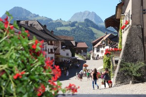
The trail leads from the little town of Gruyère past the Maison du Gruyère and then further in the direction of the Saane valley. Then it ascends again over meadows to the village of Neirivue.
The sledging run starts in Ernen village and finishes in Niederernen Z'Brigg. The nearby bus stop offers a good public transport connection.
The sledging run starts up in Cholegga and finishes in the historic village of Ernen.
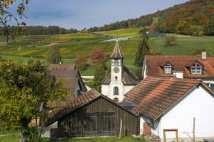
You follow the tracks of the Romans, who in those day marched along these roads from Germany to Turicum (Zurich). In Trasadingen you can sleep in a wine barrel room as did Diogenes - in the «Fasstastischen Hotel» or in the «Fasshotel».

From Schaffhausen, the Route Verte takes you to the heart of the Schaffhausen Regional Nature Park and into the "Blauburgunderland". Take a break here to taste their delicious wines.

The Jeizinen - Leuk - Sierre nature park trail combines everything that makes a nature park:
Exceptional landscapes, historic village centres and impressive views of the Rhone Valley.
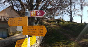
Stage 3, Weissenstein - Balsthal
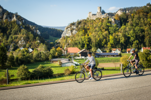
Eine vielfältige Velotour, auf welcher sich die unterschiedlichen Gesichter des Juras entdecken lassen. Zwei von insgesamt vier Etappen führen durch den Naturpark Thal.

Eine vielfältige Velotour, auf welcher sich die unterschiedlichen Gesichter des Juras entdecken lassen. Zwei von insgesamt vier Etappen führen durch den Naturpark Thal.

In zwei Etappen von Dornach bis nach Huttwil, führt Sie diese Velotour mitten durch den Naturpark Thal.
The Three Parks Hike, Stage 2 from Grimmialp to Oey
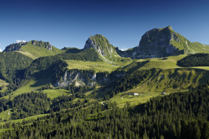
The Three Parks Hike, Stage 3, Oey-Gurnigel

Between nature, culture and heritage

Die Jurapark-Landschaft ganz bequem fahrend entdecken – das ist die Postautoreise. Die Reise führt Sie von Aarau via Frick und Laufenburg bis Brugg einmal quer durch den Jurapark Aargau.

Theme trail on all kinds of energy sources.
To optimise your experience on our website we use cookies. Privacy policy aI agree
