Sonloup – Montreux
Season
April, Mai, June, July, August, September, OctoberContact
Parc naturel régional Gruyère Pays-d'EnhautPlace du Village 6
1660 Château-d'Œx
Tel. +41 (0)848 110 888
www.gruyerepaysdenhaut.ch
Parc naturel régional Gruyère Pays-d'Enhaut - From tranquil mountain pastures to tumultuous waterfalls.
The Chauderon gorges are closed until further notice.
From Sonloup, it is a gentle climb through woodland and clearings to Le Cubly (1,187 m). There is a picnic spot next to the ruins of the 10th century Tour de Salausex that offers spectacular views of Lake Geneva.
If you are hiking from May to June, you might be lucky to see the wild narcissi in full bloom as you leave the woodland and continue along the path back to Les Avants. At the bottom of the funicular railway and just before the small church, the path turns right and leads down into another stretch of forest. It is a steep descent but the path is simple to follow and steps make it easier to navigate the most precipitous sections. Two hundred metres below and a 1 km walk away is the Baye de Montreux torrent, the last point on this stage of the trail.
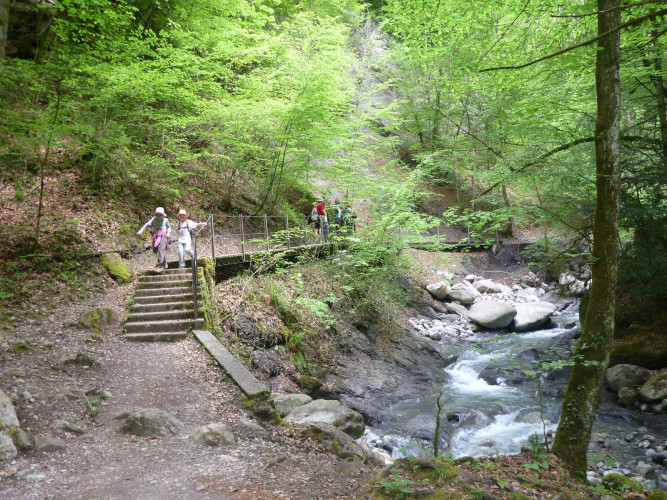
The trail continues through the first narrow pass in the Gorges du Chauderon. A short section of tarmac road leads down into the deepest part of the gorge surrounded by mesmerizingly sheer and soaring rock walls. Two kilometres further downhill is the charming district of Les Planches, the perfect spot for a leisurely stroll and a well-deserved drink on a café terrace with gorgeous views of the sun setting over Montreux and Lake Geneva.
Route-information
Route-information
- Length
- 9.10 km
- Altitude difference ascent
- 280 m
- Altitude difference descent
- 1030 m
- Time required
- 2 hours 55 minutes
- Level technique
- Middle
- Level condition
- Middle
Arrival
- Starting point
- Sonloup
- Arrival by public transport
- Sonloup Timetable SBB
- Destination
- Montreux
- Arrival by public transport
- Montreux Timetable SBB
Suitable for
The offer is suitable for
- Adults
- Families

